Japanese tsunami debris
travels across the Pacific Ocean
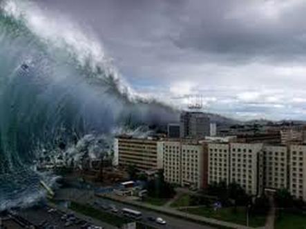
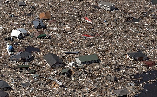
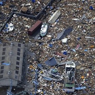
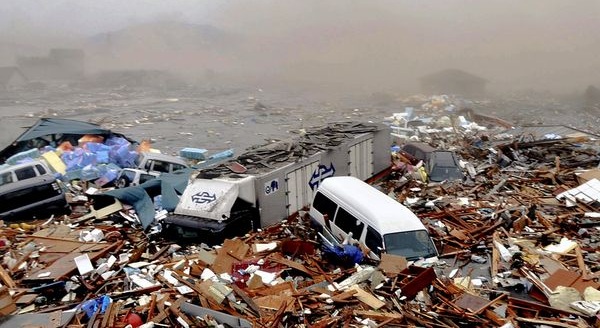
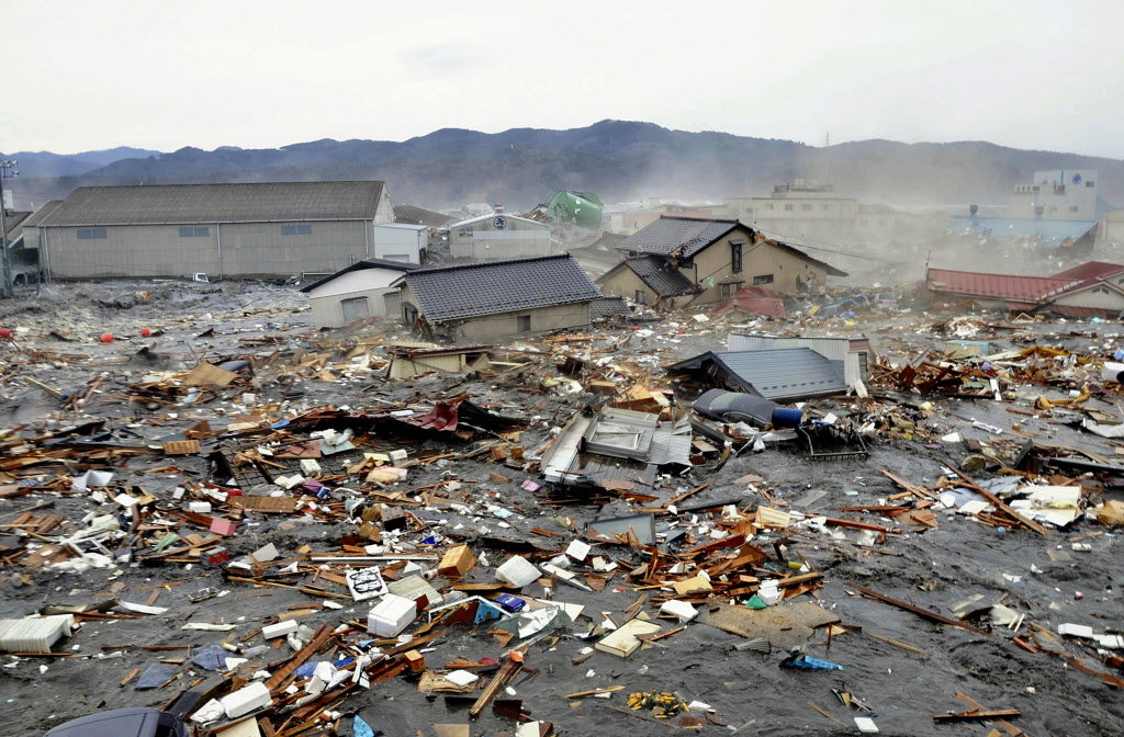
After the tsunami rolled over Japan in March 2011, entire neighborhoods looked like they had been blown away by a gang of EF-5 tornadoes. The land was so barren that the horizons swept back to infinity, with foundations of buildings serving as the only indication of a previous civilization.
But what happened to all the stuff that used to be there?
December 16, 2011
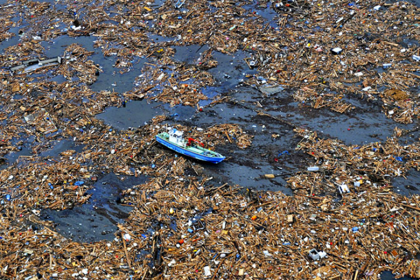
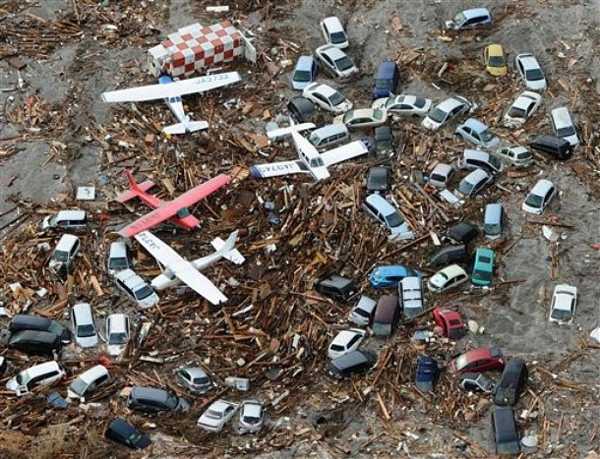
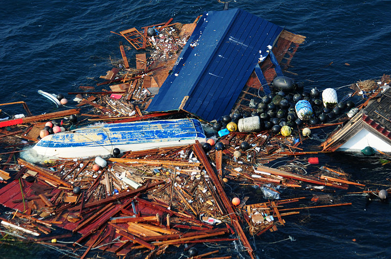
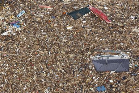
The short answer is the heaviest objects sank close to shore as the wave pulled away. As to the debris that remained buoyant, well, the U.S. government is still trying to determine where it is.
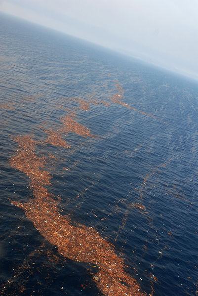
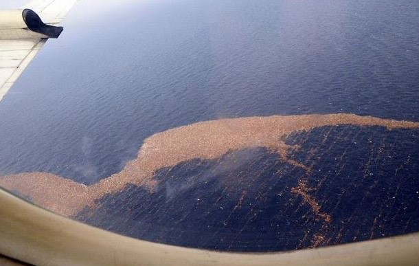
And where it's heading. Scientists at NOAA's Marine Debris Program are doing a pretty good job of scouting out the paths of the massive debris cloud that has spread throughout the Pacific Ocean. Carried on the currents like the North Pacific Gyre, thehorde of trash is slowly making the rounds of the ocean and will soon visit the United States.
The short answer is the heaviest objects sank close to shore as the wave pulled away. As to the debris that remained buoyant, well, the U.S. government is still trying to determine where it is.
And where it's heading. Scientists at NOAA's Marine Debris Program are doing a pretty good job of scouting out the paths of the massive debris cloud that has spread throughout the Pacific Ocean. Carried on the currents like the North Pacific Gyre, thehorde of trash is slowly making the rounds of the ocean and will soon visit the United States.
According to NOAA:
Right now, models tell us some debris could pass near or wash ashore in the Northwestern Hawaiian Islands as early as this (2011/2012) winter (based on reported sightings of debris by the Russian ship STS Pallada (September 2011)), approach the West Coast of the United States in 2013, and circle back to Hawaii (main Hawaiian Islands) in 2014 to 2016.
Right now, models tell us some debris could pass near or wash ashore in the Northwestern Hawaiian Islands as early as this (2011/2012) winter (based on reported sightings of debris by the Russian ship STS Pallada (September 2011)), approach the West Coast of the United States in 2013, and circle back to Hawaii (main Hawaiian Islands) in 2014 to 2016.
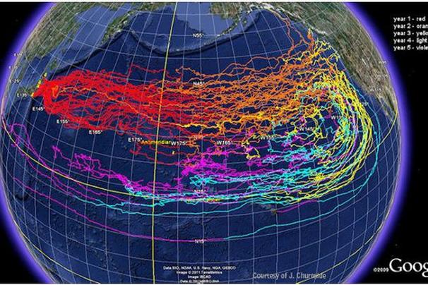
You can see the garbage's shipping schedule in the above map, which is color-coded by year. It was created by a NOAA researcher named (no joke) J. Churnside using a modeling program called the Ocean Surface Current Simulator. FYI, if you're ever out sailing or walking the beach and happen to spot some ocean-faring debris, there's an app you can use to report it to government scientists. It's fun for the whole family!
Here's another, newer animated model depicting the likely dispersion of tsunami trash. NOAA’s Earths System Research Laboratory created it by drawing upon five years of historical weather patterns. You can see the blob of debris crawling like a thicket of snakes toward Puget Sound, heading down the California coast to Mexico and wandering back out to sea to loll around Hawaii's beaches. Then, in an unfun twist, some of it seems to return to Japan:
Source: Storm Watch 7 Weather Blog
20-25 million tons of tsunami debris floating toward US shores
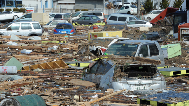
Wrecked cars, portions of homes, boats, furniture and more -- all swept up by the destructive, magnitude 9.0 earthquake that struck off the coast of Japan 11 months ago -- are on a slow-motion collision course with California.
The wreckage from the March 11, 2011, disaster could include virtually anything that floats, according to oceanographer and beachcomber Curtis Ebbesmeyer -- and that includes portions of houses, boats, ships, furniture, cars and even human remains.